• ☰ Menu
  • home
  • News
  • Archive
  • Author
  • Photos & Tweets
  • Maps
  • Links

Sudan Research, Analysis, and Advocacy

by Eric Reeves

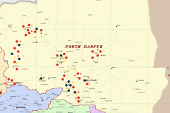
• The map of North Darfur, showing violent expropriation of non-Arab/African farmland for November 2014 – November 2015, is in PNG format; to view, please return to “Home Page” for the image.  Click on the image there and then to enlarge, click on the map image when open. The violent expropriation of non-Arab/African farmlands reached […]
• The UN Map of IDP sites in Darfur is in PNG format: to view it, please return to “Home Page” for imagine  (click on image there and then to enlarge, click on the map image when open)
Map of South Kordofan, now the focus of Khartoum's military efforts
Map of South Kordofan, now the focus of Khartoum’s military efforts (click on map to enlarge)
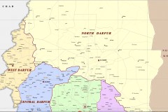
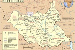
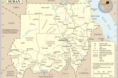
REFERENCE MAPS: Links to UN OCHA maps of Darfur, 2012 – 2013 (these surpass in reliability and completeness the OCHA Darfur Field Atlas of 2005) • Central Darfur | http://reliefweb.int/sites/reliefweb.int/files/resources/map_2981.pdf • North Darfur http://reliefweb.int/sites/reliefweb.int/files/resources/sud04_northdarfur_state_referencemap_a1_26feb13.pdf • South Darfur | http://reliefweb.int/sites/reliefweb.int/files/resources/map_2993.pdf •West Darfur | http://reliefweb.int/sites/reliefweb.int/files/resources/map_2996.pdf • East Darfur | http://reliefweb.int/sites/reliefweb.int/files/resources/map_2984.pdf
Mapping of data for “Changing the Demography”: Violent Expropriation and Destruction of Farmlands in Darfur, November 2014 – November 2015
Mapping of data for “Changing the Demography”: Violent Expropriation and Destruction of Farmlands in Darfur, November 2014 – November 2015  How to read this mapping of incidents from the data spreadsheet (scroll down to the three maps):  All incidents mapped on this scalable set of three maps (North Darfur, South Darfur, and West Darfur) are […]
Darfur (scalable map); see “Changing the Demography”
Darfur (scalable map); see “Changing the Demography,” here
Central Darfur and Jebel Marra
  This scalable map extends to North, Central, West and South Darfur; the Jebel Marra massif is in the very center of the region 
Map of Africa
Map of Africa
South Sudan
South Sudan
(Northern) Sudan
(Northern) Sudan
  • 1
  • 2
  • Next Page »

About the Author

cer1 Eric Reeves has been writing about greater Sudan for the past twenty-three years. His work is here organized chronologically, and includes all electronic and other publications since the signing of the historic Machakos Protocol (July 2002), which guaranteed South Sudan the right to a self- determination referendum. There are links to a number of Reeves’ formal publications in newspapers, news magazines, academic journals, and human rights publications, as well as to the texts of his Congressional testimony and a complete list of publications, testimony, and academic presentations.
Learn More

Photos and Tweets

See more photos

Maps

See More Maps

© 2023 · Eric Reeves · Log in