• ☰ Menu
  • home
  • News
  • Donate
  • Archive
  • Author
  • Maps
  • Links

Sudan Research, Analysis, and Advocacy

by Eric Reeves

Mapping of data for violence in South Darfur, January 1, 2017 – March 2019

19 May 2019 | Misc. Documents, Letters | Author: ereeves | 129 words


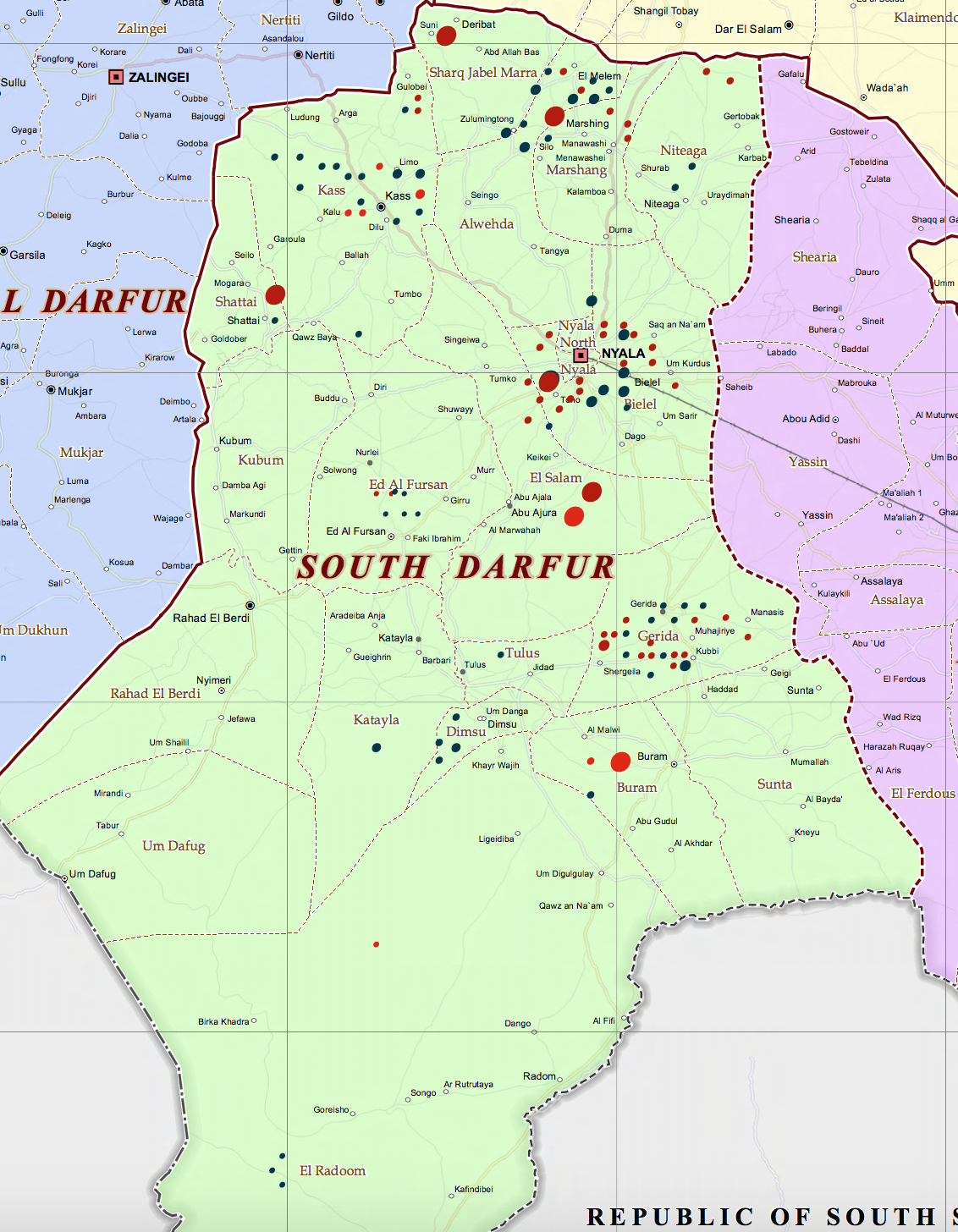
The key for the maps is as follows:

Black dots (circles) of 50pt size represent events with a scaled violence rating of 1 – 5;
Red dots of 50pt size represent events with a scaled violence rating of 6 – 10;
Black dots of 75pt size represent events with a scaled violence rating of 11 – 25;
Red dots of 75pt size represent events with a scaled violence rating of 26 – 50;
Large red dots of 200pt size represent events with a scaled violence rating of more than 50 (these are primarily used to represent inter-tribal violence among Arab groups in East Darfur and large-scale civilian displacement by military assaults)

For a full explanation of how these figures are derived, see the report’s concluding comment, THE NATURE OF THE DATA UNDERLYING THIS REPORT.

[double click for maximum expansion of map]

About the Author

cer1 Eric Reeves has been writing about greater Sudan for the past twenty-three years. His work is here organized chronologically, and includes all electronic and other publications since the signing of the historic Machakos Protocol (July 2002), which guaranteed South Sudan the right to a self- determination referendum. There are links to a number of Reeves’ formal publications in newspapers, news magazines, academic journals, and human rights publications, as well as to the texts of his Congressional testimony and a complete list of publications, testimony, and academic presentations.
Learn More

Photos and Tweets

See more photos

Maps

See More Maps

© 2025 · Eric Reeves · Log in